
For four years I’ve been following #30DayMapCallenge with admiration but not daring to commit to it. Producing maps was always an accompanying step in my main activities, and towards the end of a year it never felt possible to focus on producing them daily. This year I decided to cheat and re-publish many of my maps that accumulated over the years, and only produce new ones for a handful of days/topics. I mostly succeded with posting 25 out of 30. And out of these 25 submissions 6 are freshly coded, 2 are old educational materials turned into blog posts, and 5 more are new quick stuff done without coding. All the new code is available in the gihub repo; and the blog posts (geocoding, map-projections) contain all the necessary #rstats code inline.
Below I list all my contributions as Mastodon post embeds. I use Mastodon because it’s fully open, but the actual #30DayMapCallenge communication was mostly happening on Bluesky, which is still invite-only platform, closed to unregistered viewers. The bsky thread with my contributions is here (note that I’m linking the last post, scroll upwards). Enjoy exploring!
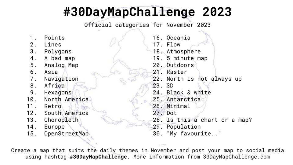
| 01 points | 16 Oceania |
| 02 lines | 17 flow |
| 03 polygons | |
| 04 a bad map | 19 5-minutes map |
| 05 analog map | 20 outdoors |
| 06 Asia | |
| 07 navigation | 22 North is not always up |
| 08 Africa | 23 3D |
| 09 hexagons | |
| 10 North America | 25 Antarctica |
| 11 retro | |
| 12 South America | |
| 13 choropleth | 28 Is it a chart or a map? |
| 14 Europe | 29 population |
| 15 openstreetmap | 30 my favourite |
2023-11-30 | my favourite
bsky | fosstodon | code | paper | reddit